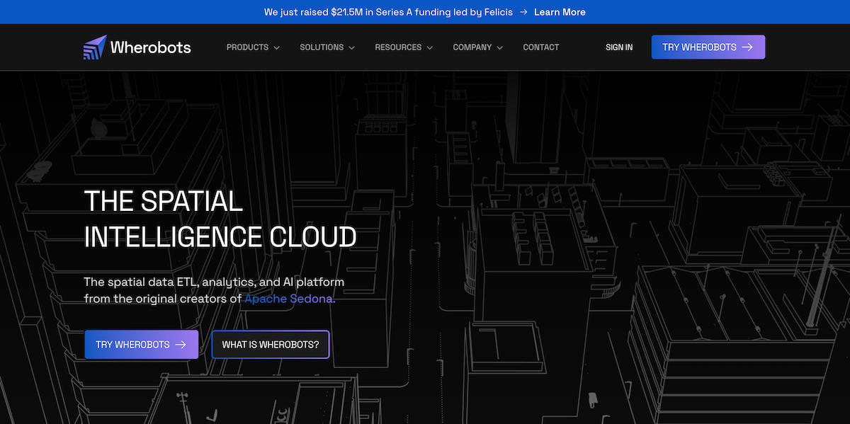
Climate data and geospatial insights hold the key to solving global challenges, Wherobots is paving the way with groundbreaking technology.
The company recently raised $21.5 million in Series A funding, led by Felicis and joined by notable investors like Wing Venture Capital, Clear Ventures, JetBlue Ventures, and P7 Ventures.
This funding enables Wherobots to scale its innovative solutions that bridge the gap between the physical and digital worlds, empowering industries to make smarter, faster, and more sustainable decisions.
Co-founded by Mo Sarwat and Jia Yu, the creators of Apache Sedona, Wherobots is not just another data analytics platform—it’s a transformative Spatial Intelligence Cloud that delivers cutting-edge geospatial and climate intelligence solutions at unprecedented speeds and scale.
Potential Positive Impacts of Wherobots Scaling
- Accelerating Climate Action: Enables real-time environmental monitoring, disaster response, carbon reduction, and renewable energy optimization.
- Transforming Industries: Revolutionizes agriculture, logistics, urban planning, and insurance with actionable geospatial insights.
- Improving Decision-Making: Facilitates faster, data-driven decisions for resource management, innovation, and environmental stewardship.
- Democratizing Geospatial Intelligence: Provides accessible, serverless tools that empower businesses of all sizes, including underserved regions.
- Supporting Sustainability Goals: Contributes to global initiatives like clean energy, sustainable urbanization, and climate action.
- Driving Economic Growth: Fuels emerging trillion-dollar markets, creates jobs, and spurs innovation across industries.
- Fostering Cross-Sector Collaboration: Promotes partnerships between private, public, and nonprofit sectors for global challenges.
The Role of Climate Intelligence in Today’s World
As the world grapples with the impacts of climate transition, the need for actionable insights has never been more urgent. Every day, satellites, drones, and sensors generate petabytes of geospatial and climate data.
This information reveals critical patterns in weather, land use, deforestation, urbanization, and more. However, the sheer volume and complexity of this data make it challenging for organizations to process and utilize effectively.
Wherobots’ Climate Intelligence capabilities address this issue head-on by enabling businesses, governments, and NGOs to harness geospatial data for climate monitoring, disaster response, and sustainable planning.
By processing data up to 20 times faster than traditional tools, Wherobots empowers stakeholders to take proactive measures in addressing environmental challenges.

Advancing Climate Solutions with Geospatial Technology
Wherobots’ platform plays a pivotal role in advancing climate intelligence across several domains:
1. Real-Time Environmental Monitoring
Wherobots allows organizations to track deforestation, rising sea levels, and urban heat islands in real time. Using satellite imagery and geospatial analytics, the platform provides timely insights for policymakers and environmentalists to act on critical issues.
2. Disaster Preparedness and Response
In the face of natural disasters like hurricanes, floods, and wildfires, rapid data processing is essential. Wherobots supports emergency management teams by providing precise geospatial data to optimize evacuation routes, allocate resources, and predict the spread of disasters.
3. Sustainable Urban Planning
With urbanization on the rise, cities must balance growth with sustainability. Wherobots helps planners assess land use, identify green spaces, and design infrastructure that minimizes environmental impact.
4. Precision Agriculture
Agriculture is a key sector impacted by climate change. Wherobots aids farmers and agricultural companies in monitoring soil health, predicting weather patterns, and optimizing water usage to enhance crop yields while reducing waste.
5. Carbon Mapping and Reduction
Wherobots enables organizations to map carbon emissions across industries and regions, helping them identify high-emission areas and devise strategies to reduce their carbon footprint. This is crucial for meeting global climate targets.
6. Renewable Energy Optimization
Renewable energy companies use Wherobots to identify optimal locations for solar farms, wind turbines, and hydroelectric plants, ensuring maximum efficiency and minimal environmental disruption.
Bridging the Climate Intelligence Gap
Traditional data processing tools fall short when it comes to climate data. They are often slow, costly, and unable to handle the unique complexities of geospatial information.
Wherobots, with its serverless architecture and support for both vector and raster data types, is purpose-built to overcome these limitations.
“Our mission is to make it easy for our customers to utilize geospatial data,” said Mo Sarwat, CEO of Wherobots. “In the context of climate intelligence, this means providing tools that accelerate the understanding of environmental changes and enabling organizations to take action at scale.”
By offering seamless integration with programming languages like SQL, Python, and Java/Scala, Wherobots democratizes access to advanced geospatial analytics, ensuring that more industries can contribute to climate solutions.
Leading the Way in Climate and Geospatial Intelligence
Wherobots has already gained traction with leading organizations across industries. The Overture Maps Foundation, which includes Meta, Microsoft, Amazon, and TomTom, leverages Wherobots for global mapping initiatives that inform urban planning and disaster preparedness.
Additionally, companies like Land O’Lakes use Wherobots and Apache Sedona to optimize precision farming practices, minimizing environmental impact while maximizing efficiency.
Amazon Last Mile Delivery integrates Apache Sedona to streamline logistics and reduce carbon emissions, showcasing the platform's versatility.
Scaling Climate Intelligence with Cloud Integration
As part of its mission to expand access to climate intelligence, Wherobots recently launched on the AWS Marketplace, making it easier for organizations to integrate geospatial solutions into their workflows.
With the ability to leverage AWS committed spend and unified billing, companies can seamlessly scale their climate data initiatives without incurring prohibitive costs.
At AWS Re:Invent, Wherobots will highlight its role in enabling cloud-native geospatial solutions, further cementing its position as a leader in climate and geospatial intelligence.
Subscribe on Apple Podcasts
Subscribe on Spotify
Subscribe on Amazon Music


